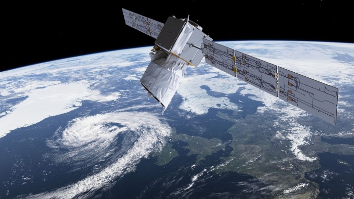
Satellite tech takes connectivity into new dimensions

Roula Khalaf, Editor of the FT, selects her favourite stories in this weekly newsletter.
Space technologies form part of the national infrastructure and are the foundation of many services on which we all depend in our day-to-day lives.
Satellite television accounts for almost 30 per cent of this $335bn industry, while about a quarter of the revenue is related to global navigation satellite systems such as GPS. Governments’ space budgets represent almost a quarter, with the remainder coming from other satellite services — from broadband telecoms to surveillance and remote sensing.
The various satellite technologies can be classified in terms of their orbits around earth.
Low earth orbit (LEO) satellites travel around the globe at an altitude of 160km-2,000km. It can take as little as 1.5 hours to do a complete orbit. This means an observer at a ground station can see the satellite for just a few minutes, from the moment it rises above the horizon to when it disappears. This significantly limits communications. However as the satellite is closer to the ground it can perform high-resolution remote sensing or surveillance.
The short distance from the station not only means less power is needed to transmit data versus higher orbits, there is also lower latency — ie the time between a signal being sent and received. This enables real-time interactive activities such as trading and banking or some video games.
Launching a satellite into LEO costs from $5,000/kg — much less than with higher orbits. But in order to exploit the advantages of LEO and bypass its drawbacks, a system requires a constellation of satellites and ground stations for effective communication.
Recent growth in the ability to manage complex networks is enabling constellations of hundreds of satellites to be positioned in different orbits to cover the planet — all underpinned by advancements in microwave technologies as well as future laser communications.
The radiation environment in LEO is also relatively benign, reducing the need for expensive radiation-hardened electronic parts, and allowing the use of commercial, off-the-shelf components at the lower end of the market, such as nanosatellites and cubesats.
The resulting cost reductions allow such megaconstellations to help satisfy growing demand for broadband connectivity across the globe.
In addition, the drag in lower orbits that gradually lowers the altitude of the satellite until it burns into the atmosphere helps to dispose of the crafts at the end of their useful life, thus reducing the problem of space junk.

Geostationary orbit (GEO) satellites are at an altitude of 35,786km. Increasing the altitude of the orbit slows its speed: here, it takes one day to travel around the globe. If this orbit is in the same plane as the equator and the satellite travels in the direction of the Earth’s rotation, the satellite will appear fixed in the sky — hence the name geostationary.
From this position, the satellite is within range of around a third of the planet and can communicate with areas the size of continents. This provides great downstream connectivity and is ideal for services such as television broadcasting and weather forecasting.
The higher latency compared with LEO is not an issue for most telecommunication and data services; there are also several GEO telecoms satellites, for example.
A drive to cut the costs associated with very large satellites (above 5 tonnes, say), which can cost hundreds of millions of dollars, has shifted the trend towards lighter satellites that use electric propulsion systems for their manoeuvres. These reduce the need for large amounts of chemical propellant whose mass typically makes up a significant fraction of a GEO satellite.
Reusable launch vehicles also promise further cost savings. However, before investing in GEO, some customers have to be reassured that their satellites will stay competitive against different solutions, which may deliver similar services at a lower cost. This has contributed to a downturn in new orders over the past few years, with manufacturers reporting that requests slipped to an average of 17 in 2016, down from 20-25 previously.
Medium earth orbit (MEO) satellites orbit between LEO and GEO, and potentially merge the advantages of both. Low power requirements, high bandwidth and low latency make them suitable for interactive broadband applications. In use since the 1960s for telecommunication, their orbits can cover the polar regions not usually served by GEO.
As an example, 24 satellites in MEO orbits are enough to cover the whole Earth, with four satellites visible from the ground at any one time. This makes them particularly suitable for navigation systems such as GPS or the new European Galileo system.
Further growth in the MEO segment is expected. However, for their intrinsic characteristics LEO and GEO will continue to be the best options for applications such as broadcasting, surveillance and other commercial and scientific uses.
Guglielmo Aglietti is professor of space engineering and director of the Surrey Space Centre at the University of Surrey

Comments